


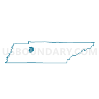
6-8 South McEwen Voting District, Humphreys County, Tennessee
About
Outline

Summary
| Unique Area Identifier | 668889 |
| Name | 6-8 South McEwen Voting District |
| County | Humphreys County |
| State | Tennessee |
| Area (square miles) | 83.36 |
| Land Area (square miles) | 83.34 |
| Water Area (square miles) | 0.02 |
| % of Land Area | 99.97 |
| % of Water Area | 0.03 |
| Latitude of the Internal Point | 36.00661600 |
| Longtitude of the Internal Point | -87.62964850 |
Maps


Graphs
Select a template below for downloading or customizing gragh for 6-8 South McEwen Voting District, Humphreys County, Tennessee


Neighbors
Neighoring Voting District (by Name) Neighboring Voting District on the Map
- 01-2 Nunnelly Voting District, Hickman County, TN
- 01-3 Pinewood Voting District, Hickman County, TN
- 02-1 Eno Methodist Voting District, Dickson County, TN
- 02-2 Tennessee City C.C. Voting District, Dickson County, TN
- 3-4 MLEC Voting District, Humphreys County, TN
- 5-6 Ag Center Voting District, Humphreys County, TN
- 5-7 Buffalo Voting District, Humphreys County, TN
- 7-9 North McEwen Voting District, Humphreys County, TN
Top 10 Neighboring County Subdivision (by Population) Neighboring County Subdivision on the Map
- District 1, Hickman County, TN (3,793)
- District 2, Dickson County, TN (3,677)
- District 7, Humphreys County, TN (2,806)
- District 6, Humphreys County, TN (2,798)
- District 3, Humphreys County, TN (2,511)
- District 5, Humphreys County, TN (2,418)
Top 10 Neighboring Place (by Population) Neighboring Place on the Map
Top 10 Neighboring Unified School District (by Population) Neighboring Unified School District on the Map
- Dickson County School District, TN (49,666)
- Hickman County School District, TN (24,690)
- Humphreys County School District, TN (18,538)
Top 10 Neighboring State Legislative District Lower Chamber (by Population) Neighboring State Legislative District Lower Chamber on the Map
Top 10 Neighboring State Legislative District Upper Chamber (by Population) Neighboring State Legislative District Upper Chamber on the Map
Top 10 Neighboring 111th Congressional District (by Population) Neighboring 111th Congressional District on the Map
Top 10 Neighboring Census Tract (by Population) Neighboring Census Tract on the Map
- Census Tract 1303, Humphreys County, TN (5,599)
- Census Tract 1301, Humphreys County, TN (5,399)
- Census Tract 607, Dickson County, TN (4,388)
- Census Tract 1304, Humphreys County, TN (2,582)
- Census Tract 9505, Hickman County, TN (2,403)